
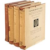
Innermost Asia.
Detailed report of explorations in Central Asia, Kan-su and eastern Iran. Carried out and described under the orders of H.M. Indian Government. Volumes I and II, Text. Vol.III, Plates and Plans. Vol.IV, Maps. With descriptive lists of antiques by F.H. Andrews and F.M.G. Lorimer; and appendices by J. Allan, E. Benveniste, A.H. Francke, L. Giles, R.L. Hobson, T.A. Joyce, S. Konow, A. von Le Coq, W. Lentz, S. Lévi, H. Maspero, F.E. Pargiter, R. Smith, W.J. Sollas, R.C. Spieler, F.W. Thomas, V. Thomsen. Oxford At the Clarendon Press 1928
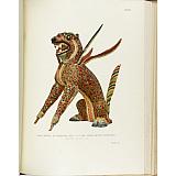
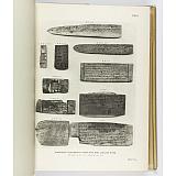
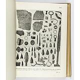
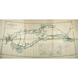
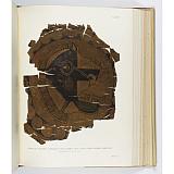
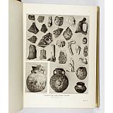
First edition, four volumes, folio, pp.xxxix, 547; xii, (549)-1159, 505 photographic illustrations; 138 plates (numbered to 137, with one A plate), 13 in colour, 59 plans; 52 folding maps. A very good set in original cloth. Rather torn and soiled dust wrappers. From the library of Stein's friend and colleague, Filippo de Filippi, with his bookplate.
Erdelyi 1.112.
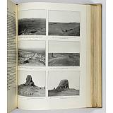
The detailed scientific report on Aurel Stein's third great Central Asian Expedition in which he covered nearly 11,000 miles in thirty-two months between 1913 and 1916, and pursued geographical as well as archaeological research. From Kashmir Stein followed the pilgrim route to Kashgar, crossed the Taklamakan desert to Khotan, and explored the Lop desert discovering the ancient site of Lou-lan. He revisited the "Caves of the Thousand Buddhas", pushed down the Etsin-gol and investigated Khara-khoto, the site first discovered by Colonel Kozlov. From there to Turfan, where the expedition secured "a considerable collection of interesting mural paintings from ruined Buddhist shrines". When arrangements had been made to transport the 182 cases of antiquities collected to Kashmir, Stein crossed the Pamirs and the valleys of the Upper Oxus passing Bokhara and Samarkand on his way to Sistan. In the first two volumes Stein provides a record of his journey and of the antiques he collected, with 505 photographic illustrations. The plate volume has 138 superbly printed plates, 13 of which are in colour. The map volume contains an index map, 47 sheet maps of portions of Chinese Turkestan and Kansu from surveys made during the explorations of 1900-01, 1906-08, and 1913-15, on a scale of 1:500,000, and four related maps.